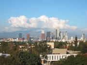
Greater Los Angeles Area
 Common name: Greater Los Angeles Area |
|
| Largest city | Los Angeles |
| Other cities | - Long Beach - Santa Ana - Anaheim - Riverside - San Bernardino - Glendale - Irvine - Pasadena |
| Population | Ranked 2nd in the U.S. |
| - Total | CSA: 17,786,419 [1] |
| Area | 33,954 sq. mi. 87,490 km² |
| State(s) | California |
| Elevation | |
| - Highest point | San Gorgonio Mountain 11,499 feet (3,505 m) |
| - Lowest point | Wilmington[2] -9 feet (3 m) |

The Greater Los Angeles Area, or the Southland, is a popular term for the agglomeration of urbanized area around the county of Los Angeles, California. The terms are not officially defined but are in common use in speech and writing[3] [4] to refer to the more-or-less continuously urbanized area stretching from Ventura or even Santa Barbara in the north to the southern border of Orange County, and from the Pacific Ocean to the Inland Empire.[5] The Greater Los Angeles area is generally taken to include the Los Angeles metropolitan area, the Inland Empire, and the Oxnard–Thousand Oaks–Ventura area.[6] The term "Greater Los Angeles" does not include San Diego and Imperial counties, whose urbanized areas are not geographically continuous with the urbanized area surrounding Los Angeles. However, the term "Southland" is sometimes used to refer to all of Southern California.[7]
It is the most commonly used term for the Combined Statistical Area (a group of interacting metropolitan areas) sprawled over five counties in the southern part of California, namely Los Angeles County, Orange County, San Bernardino County, Riverside County and Ventura County. A common unofficial definition includes the region ranging from Ventura County to the Cucamonga Valley southwestern area of San Bernardino County. The region contains some of the most affluent areas of the country. It has been one of the fastest growing regions in the United States for decades, first in Los Angeles County, then Orange County, and now in the Inland Empire. As of 2005, the official estimate of the population of the Los Angeles metropolitan area is more than 12.9 million, while the larger five-county region has a population of over 17.6 million. Either definition makes it the second-largest core-based statistical area[8] in the country, behind the New York metropolitan area.
The United States Census Bureau has designated the five county region as the Los Angeles-Long Beach-Riverside combined statistical area, with a July 1, 2006 population estimate of 17,776,000.[9] According to the U.S. Census Bureau, the Los Angeles metropolitan area has a total area of 4,850 square miles (12,561.442 km2), while the wider combined statistical area covers 33,954 square miles (87,940.456 km2), but more than half of this is the sparsely populated eastern areas of Riverside and San Bernardino counties.
Contents |
Metropolitan Statistical Area

The counties and county groupings comprising the Los Angeles Metropolitan Area are listed below with 2008 U.S. Census Bureau estimates of their populations.[1]
Los Angeles-Long Beach-Santa Ana, CA Metropolitan Statistical Area (12,872,808)
- Los Angeles-Long Beach-Glendale, CA Metropolitan Division (9,862,049)
- Los Angeles County (9,862,049)
- Santa Ana-Anaheim-Irvine, CA Metropolitan Division (3,010,759)
- Orange County (3,010,759)
Combined Statistical Area
In addition to the Los Angeles-Long Beach-Santa Ana, CA Metropolitan Statistical Area, the following Metropolitan Statistical Areas are also included in the Los Angeles-Long Beach-Riverside, CA Combined Statistical Area (total pop. 17,786,419):[1]
- Oxnard-Thousand Oaks-Ventura, CA Metropolitan Statistical Area (797,740)
- Ventura County (797,740)
- Riverside-San Bernardino-Ontario, CA Metropolitan Statistical Area (4,115,871)
- Riverside County, California (2,100,516)
- San Bernardino County, California (2,015,355)
The combined statistical area is a multicore metropolitan region containing several urban areas.
| Population Rank |
Urbanized Area | State(s) | 2000 Population |
|---|---|---|---|
| 2 | Los Angeles–Long Beach–Santa Ana | CA | 11,789,487 |
| 14 | Riverside–San Bernardino | CA | 1,506,816 |
| 68 | Mission Viejo | CA | 533,015 |
| 91 | Oxnard | CA | 337,591 |
| 123 | Palmdale–Lancaster | CA | 263,532 |
| 125 | Indio–Cathedral City–Palm Springs | CA | 254,856 |
| 131 | Temecula–Murrieta | CA | 229,810 |
| 143 | Thousand Oaks | CA | 210,990 |
| 150 | Victorville–Hesperia–Apple Valley | CA | 200,436 |
| 176 | Santa Clarita | CA | 170,481 |
| 227 | Hemet | CA | 117,200 |
| 238 | Simi Valley | CA | 112,345 |
| 368 | Camarillo | CA | 62,798 |
Economic Area
The Bureau of Economic Analysis defines an even larger region known as an "economic area", which delineates the relevant regional market surrounding a metropolitan area. Economic areas consist of one or more economic nodes, which are MSAs or CSAs. Economic areas are defined as a collection of nodes and other outlying counties on the basis of commuting data and newspaper circulation data.
The Los Angeles Economic Area consists of the following nodes:
- Los Angeles-Long Beach-Riverside CSA
- San Luis Obispo-Paso Robles MSA
- Bakersfield MSA
- Santa Barbara-Santa Maria-Goleta MSA
- El Centro MSA
- Yuma MSA
In addition to the above, the economic area includes La Paz County in Arizona, and Inyo and Mono counties in California.
Counties in the Southland

- Los Angeles-Long Beach-Santa Ana Metropolitan Area
- Riverside-San Bernardino-Ontario Metropolitan Area
- Oxnard-Thousand Oaks-Ventura Metropolitan Area
Regions of the Southland


- Antelope Valley
- Downtown Los Angeles
- Conejo Valley
- Crescenta Valley
- East Los Angeles
- Gateway Cities
- Orange County
- Oxnard Plain
- San Fernando Valley
- San Gabriel Valley
- Santa Clarita Valley
- South Bay
- South Los Angeles
- West Los Angeles
Principal cities
The following is a list of principal cities in the Greater Los Angeles Area with 2009 California Department of Finance estimates of their population:[10]

Los Angeles–Long Beach–Santa Ana MSA
|
|
|
Riverside–San Bernardino–Ontario MSA

|
|
Oxnard–Thousand Oaks–Ventura MSA

-
- Oxnard (197,067)
- Thousand Oaks (128,564)
- Simi Valley (125,814)
- Ventura (108,787)
- Camarillo (66,149)
Geography

Urban Form

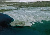
Los Angeles has a long-standing reputation for sprawl. However, according to the 2000 Census, the "Los Angeles-Long Beach-Santa Ana" Urbanized Area had a population density of 7,068 inhabitants per square mile (2,729 /km2), covering 1,668 square miles (4,320 km2) of land area, making it the most densely-populated Urbanized Area (as defined by the United States Census Bureau) in the United States.[11] For comparison, the "New York–Newark" Urbanized Area as a whole had a population density of 5,309 per square mile (2,050 /km2), covering 3,353 square miles (8,684 km2) of land area.
The popular conception of Los Angeles as a sprawling city may originate in the region's decentralized structure. Rather than being concentrated in a single downtown area, the region's major cultural, commercial, residential, political, industrial, and institutional resources are geographically dispersed. While the overall density of the city (municipality) of Los Angeles is low compared to some other large American cities (less than one-third the density of New York City, for instance),[12] the region includes largely uninhabited areas such as parts of the Santa Monica Mountains. Also, many of the city's suburban satellites have densities among the highest in the nation.[13] The population density of the central area was more than 13,500 per square mile (5,212 /km2) in 2000.[14] Within its urbanized areas, Los Angeles is noted for small lot sizes, low vacancy rates, and general lack of large exurban spreads. Buildings in the area are low high when compared to other large cities because of aesthetically-focused zoning regulations. Los Angeles became a major city just as the Pacific Electric Railway spread population to smaller cities much as interurbans did in East Coast cities. In the first decades of the twentieth century, the area was marked by a network of fairly dense but separate cities linked by rail. The ascendance of the automobile helped fill in the gaps between these commuter towns with lower-density settlements.[15]

Suburban areas surround the city of Los Angeles on all sides. Starting in the early twentieth century, there was a large growth in population on the western edges of the city moving to the San Fernando Valley and out into the Conejo Valley in eastern Ventura County. Much of the working class whites migrated to this area during the 1960s and 1970s out of East and Central Los Angeles.[16] As a result, there was a large growth in population into the Conejo Valley and into Ventura County through the US 101 corridor. Making the US 101 a full freeway in the 1960s and expansions that followed helped make commuting to Los Angeles easier and opened the way for development westward. Development in Ventura County and along the US 101 corridor remains controversial, with open-space advocates battling those who feel business development is necessary to economic growth.[17] Although the area still has abundant amount of open space and land, almost all of it was put aside and mandated never to be developed as part of the master plan of each city. Because of this, this area which was once a relatively inexpensive area to buy real estate, saw rising real estate prices well into the 2000s.[18] Median home prices in the Conejo Valley for instance, now range from $700,000 to $2.2 million.[19]
The Los Angeles area continues to grow, principally on the periphery where new, cheaper, undeveloped areas are being sought.[20] As such, in these areas, populations as well as housing prices exploded, although the housing bubble popped late in the decade of the 2000s. Riverside and San Bernardino Counties, which contain large swaths of desert, attracted most of the population increase between 2000 and 2006. Growth continues not only outside the existing urbanized area but also adjacent to existing development in the central areas.[21] As in virtually all US core cities, there is now vigorous residential development in the downtown area with both new buildings and renovation of former office buildings. The Los Angeles Downtown News keeps a list of ongoing development projects, updated every quarter [2].
Identity
The term "Greater Los Angeles" can be used to denote the metropolitan area or the consolidated area. The term "Southland" is more nebulous and can refer to either. Additionally, the Southland is used more so in local media than by residents. As is the case in virtually all major metropolitan areas, most employment is now outside the downtown core and many people commute and conduct all of their daily activities in suburban areas, such as the large counties and the municipalities that are outside the city of Los Angeles.[22]
Regional identity remains a contentious issue, with many residents refusing to acknowledge any association with the whole. For example, while Los Angeles County and Orange County share a geographical border, the two also share a host of sharp demographic, political, and financial distinctions. Orange County is often identified apart from Los Angeles in popular media and by residents. Relatively few people living in Orange County commute to Los Angeles for employment. Western Riverside County and San Bernardino County have become commuter regions characteristic of other suburban counties throughout the nation. Most residents in these counties commute to Los Angeles County and Orange County for employment.[23] Riverside County and San Bernardino County also maintain distinct identities because of their geographical boundaries and vast distances that separate the eastern portions of those counties from the rest of the Los Angeles area.
Boundaries

Some areas are bounded by natural features such as mountains or the ocean; others are marked by city boundaries, freeways, or other constructed landmarks. For example, Downtown Los Angeles is the area of Los Angeles roughly enclosed by three freeways and one river: the Harbor Freeway (SR 110) to the west, the Santa Ana Freeway (US 101) to the north, the Los Angeles River to the east, and the Santa Monica Freeway (I-10) to the south. Or, the San Fernando Valley: lying north-northwest of downtown ("The Valley") is a 15 miles (24 km) wide basin ringed by mountains.
Some other areas of Los Angeles include the Westside; South L.A. (formerly known as South Central L.A.); and the San Pedro/Harbor City area. Adjoining areas that are outside the actual city boundaries of the incorporated city of Los Angeles include the South Bay, the Gateway Cities, the San Gabriel Valley and the Foothills. The San Pedro/Harbor City area was annexed by the city of Los Angeles so the city could have access to and control over the Port of Los Angeles. It is connected to the rest of L.A. only by a narrow corridor that generally follows the Harbor Freeway. Many Angelenos consider the Eastside to be the area east of the Los Angeles River, south of Glendale and Pasadena, and north of the Gateway Cities, including the area of unincorporated Los Angeles County that includes East Los Angeles.
The city boundaries are quite complicated. For example, Beverly Hills and West Hollywood are completely surrounded by the City of Los Angeles except for a small border the two cities share. Culver City is surrounded by L.A. except where it shares a boundary with the unincorporated communities of Ladera Heights and Baldwin Hills. Both Santa Monica and the unincorporated area of Marina del Rey are surrounded except on their ocean side. San Fernando in the northern corner of the San Fernando Valley is also a separate city entirely surrounded by L.A. territory. Despite the large footprint of the City of L.A., a majority of the land area within Los Angeles County is unincorporated and under the primary jurisdiction of Los Angeles County. Most of the unincorporated land, however, is part of the Santa Monica and San Gabriel mountain ranges, or the Mojave Desert, and is thus primarily undeveloped, except on the fringes of the incorporated cities, but there are several fully built-out, but unincorporated areas in the contiguous urbanized part of the region, one of the most well-known being East Los Angeles.
Demographics
| Historical populations | |||
|---|---|---|---|
| Census | Pop. | %± | |
| 1900 | 250,187 |
|
|
| 1910 | 648,316 | 159.1% | |
| 1920 | 1,150,252 | 77.4% | |
| 1930 | 2,597,066 | 125.8% | |
| 1940 | 3,252,720 | 25.2% | |
| 1950 | 4,934,246 | 51.7% | |
| 1960 | 7,751,616 | 57.1% | |
| 1970 | 9,972,037 | 28.6% | |
| 1980 | 11,497,486 | 15.3% | |
| 1990 | 14,531,529 | 26.4% | |
| 2000 | 16,373,645 | 12.7% | |
| historical data source:[24] | |||
According to the 2000 census, there were 16,373,645 people residing in the Greater Los Angeles Area. The racial makeup of the area was 55.14% White (39.01% White Non-Hispanic), 10.39% Asian, 0.29% Pacific Islander, 7.60% African American, 0.87% Native American, 21.00% from other races, and 4.70% from two or more races. 40.30% of the population were Hispanic of any race. 30.95% of the population (5.068 million) was foreign born; of this, 62.07% came from Latin America, 28.93% from Asia, 6.00% from Europe, and 3.00% from other parts of the world. 20.22% of the population (3.310 million) was born in different states.
The explosive growth of the region in the 20th century can be attributed to its favorable Mediterranean climate, the availability of land and many booming industries such as oil, automobile and rubber, motion pictures and aerospace which in turn attracted millions of people from all over the United States and world. Citrus production was important to the region's development in the earlier part of the 20th century.[25]
While the New York metropolitan area is presently the most populous metropolitan area in the United States, it has been predicted in the past that Greater Los Angeles will eventually surpass Greater New York in population. Whether this will happen is yet to be seen, but past predictions on this event have been off the mark. A 1966 article in Time Magazine predicted Greater Los Angeles would surpass New York by 1975, and that by 1990, would reach close to the 19 million mark.[26] But the article's flawed definition of Greater Los Angeles included San Diego, which is actually its own metropolitan area. A 1989 article in The New York Times predicted Greater Los Angeles would surpass Greater New York by 2010[27], but the article predicted the population would be 18.3 million in that year, a number Greater New York has already surpassed as of 2007 by half a million people. Because present statistics for 2008 are unknown, according to the most recent numbers, Greater New York in 2007, using the Combined Statistical Area, had just over 4.2 million more people (21.97 million) than Greater Los Angeles had in 2006 (est.).
Politics
| Year | GOP | DEM | Others |
|---|---|---|---|
| 2008 | 37.3% 2,099,609 | 60.8% 3,425,319 | 1.9% 107,147 |
| 2004 | 45.3% 2,490,150 | 53.4% 2,932,429 | 1.3% 69,649 |
| 2000 | 41.3% 2,003,114 | 54.6% 2,652,907 | 4.1% 198,750 |
| 1996 | 38.3% 1,661,209 | 51.3% 2,220,837 | 10.4% 449,706 |
| 1992 | 33.8% 1,657,151 | 45.0% 2,202,345 | 21.2% 1,038,448 |
| 1988 | 53.8% 2,408,696 | 45.0% 2,014,670 | 1.2% 54,441 |
| 1984 | 60.6% 2,614,904 | 38.3% 1,650,231 | 1.1% 48,225 |
| 1980 | 55.5% 2,187,859 | 35.0% 1,381,285 | 9.5% 374,993 |
| 1976 | 50.8% 1,877,267 | 46.7% 1,728,532 | 2.5% 93,554 |
| 1972 | 57.7% 2,346,127 | 38.7% 1,573,708 | 3.6% 146,653 |
| 1968 | 50.3% 1,836,478 | 43.0% 1,570,478 | 7.3% 247,280 |
| 1964 | 44.0% 1,578,837 | 55.9% 2,006,184 | 0.1% 2,488 |
| 1960 | 50.8% 1,677,962 | 48.9% 1,612,924 | 0.3% 10,524 |
Greater Los Angeles is a politically divided metropolitan area. During the 1970s and 1980s the region leaned toward the Republican Party. Los Angeles County, the most populous of the region, is a Democratic stronghold. Ventura County, Riverside County, and San Bernardino County are relative Republican strongholds, but are increasingly becoming Democratic. Orange County is more Republican compared to the other counties.
Economy
Greater Los Angeles Area is an economic powerhouse, ranking as the third largest metropolitan economy in the world, behind Greater Tokyo Area and New York Metropolitan Area. A 2005 PricewaterhouseCoopers study showed that Los Angeles urban area had a $639 billion economy.[28] Greater Los Angeles (including Inland Empire and Ventura county) had a $770.6 billion economy.[29]
Greater Los Angeles Area is the home of the US National headquarters of almost all Asian car manufacturers except Nissan and Subaru (Nissan moved to Tennessee); Toyota, Honda, Mazda, Mitsubishi, Suzuki, Hyundai and Kia have set up their National headquarters here.
As the "Entertainment Capital of the World", Los Angeles features an abundance of attractions, and the Greater L.A. Area is one of the most visited areas in the world. Major attractions include:
Theme parks

- Disneyland
- Disney's California Adventure
- Knott's Berry Farm
- Pacific Park
- Six Flags Magic Mountain
- Universal Studios Hollywood
Beaches

- Malibu
- Venice Beach
- Huntington Beach
- Laguna Beach
- Dana Point
- Sunset Beach
- Bolsa Chica State Beach
- Newport Beach
- Manhattan Beach
- Hermosa Beach
- Redondo Beach
- San Clemente
- Santa Monica
Shopping

- Americana at Brand
- Bella Terra
- Beverly Center
- The Block at Orange
- Cerritos Auto Square
- Cerritos Towne Center
- Downtown Disney
- Fashion Island
- Glendale Galleria
- The Grove at Farmer's Market
- Hollywood and Highland
- Irvine Spectrum Center
- Los Cerritos Center
- Old Pasadena
- Ontario Mills
- Paseo Colorado
- Rodeo Drive
- South Coast Plaza
- Third Street Promenade
- Universal CityWalk
- Valencia Town Center
- Victoria Gardens
- Westfield Century City
- Westfield MainPlace
- Westfield Santa Anita
- Westfield Topanga
- Westside Pavilion
Motion picture studios

- CBS Television City
- CBS Studio Center
- CBS Columbia Square
- Charlie Chaplin Studios
- Ren-Mar Studios
- Paramount Studios
- NBC Studios
- Walt Disney Studios
- Golden Oak Ranch
- Hollywood Center Studios
- Universal Studios
- The Prospect Studios
- Metromedia Square
- Santa Clarita Studios
- Nestor Studios
- 20th Century Fox
- Sony Pictures Entertainment
- Fox Television Center
- Nickelodeon Animation Studios
- Sunset Gower Studios
- Downey Studios
- Warner Brothers Studios
Waterparks
- Raging Waters
- Knott's Soak City USA
- Six Flags Hurricane Harbor
- Wild Rivers
Zoos and aquariums
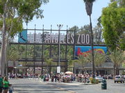
- Los Angeles Zoo
- Santa Ana Zoo
- Aquarium of the Pacific
Nightlife
- Hollywood
- West Hollywood
- Sunset Strip
- Santa Monica
- Huntington Beach
Museums
See also, Los Angeles City Museums

- Bowers Museum
- Heritage Square Museum
- California Science Center
- Discovery Science Center
- Getty Center
- Getty Villa
- Griffith Observatory
- Huntington Library
- La Brea Tar Pits
- Los Angeles County Museum of Art
- Natural History Museum of Los Angeles County
- Norton Simon Museum
- Kidspace Children's Museum
- Museum of Contemporary Art, Los Angeles
- Museum of Latin American Art
- Museum of Tolerance
- Petersen Automotive Museum
- Toyota USA Automobile Museum
Presidential Museums
- Richard Nixon Presidential Library and Museum
- Ronald Reagan Presidential Library
Other
- Queen Mary
- Mission Inn
Commercial airports
| Airport | IATA code | ICAO code | County |
|---|---|---|---|
| Los Angeles International Airport | LAX | KLAX | Los Angeles |
| LA/Ontario International Airport | ONT | KONT | San Bernardino |
| John Wayne Airport | SNA | KSNA | Orange |
| Bob Hope Airport | BUR | KBUR | Los Angeles |
| Long Beach Municipal Airport | LGB | KLGB | Los Angeles |
Sports
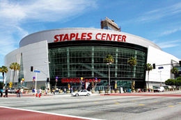
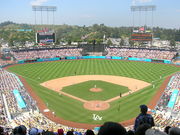
Major sports teams serving the Greater Los Angeles area include the Los Angeles Clippers and Los Angeles Lakers of the National Basketball Association, the Los Angeles Angels of Anaheim and Los Angeles Dodgers of Major League Baseball, the Los Angeles Kings and Anaheim Ducks of the National Hockey League, the Los Angeles Galaxy and Chivas USA of Major League Soccer, and the Los Angeles Sparks of the Women's National Basketball Association. The Greater Los Angeles area also has two well-known horse racing facilities: Santa Anita Park and Hollywood Park Racetrack, and four major motorsport venues: Auto Club Speedway, Long Beach street circuit, Irwindale Speedway and Auto Club Raceway at Pomona.
The Los Angeles media market currently lacks a National Football League team. After the 1994 season, the Los Angeles Rams moved to St. Louis, Missouri and the Los Angeles Raiders returned to their original home of Oakland, California.{[Fact}}
There were several years that made Los Angeles area sports dominate:{[Fact}}
- 1972: The Lakers, having won 33 straight games at one point in the regular season, finally won their first NBA championship in Los Angeles, with a victory over the New York Knicks in the NBA Finals. The UCLA Bruins won their eighth national championship in Division I basketball overall, and a sixth consecutive during their amazing tenure with John Wooden as coach. The USC Trojans got their seventh national championship in Division I-A football, with a victory over the Ohio State Buckeyes in the Rose Bowl Game.
- 1988: Having guaranteed a repeat during the 1987 championship parade, head coach Pat Riley and the Lakers became the first repeat champions in the NBA in 19 years, with a victory in the 1988 NBA Finals over the Detroit Pistons. In the summer, the Los Angeles Kings acquired Wayne Gretzky from the Edmonton Oilers,{[Fact}} and the Dodgers pulled an improbable run to the World Series championship, with victories over the New York Mets in the NLCS, and the Oakland Athletics in the World Series.
- 2002: The Los Angeles Lakers (NBA), Los Angeles Sparks (WNBA), Los Angeles Galaxy (MLS), and Anaheim Angels (MLB) each won championships,{[Fact}} giving the Los Angeles area 4 major professional titles in a single year. The Lakers won a third consecutive championship, with a victory over the New Jersey Nets in the NBA Finals. The Sparks won their second consecutive title. Meanwhile, the titles for the Angels and Galaxy were a first for each of them. The Galaxy beat the New England Revolution in the MLS Cup, while the Angels beat the San Francisco Giants in the 2002 World Series.{[Fact}}
In 2007, the Los Angeles area finally acquired the only title that had eluded the region, when the Anaheim Ducks captured the Stanley Cup chamipionship over the Ottawa Senators, in the 2007 Stanley Cup Finals.
As a whole, the Los Angeles area has more national championships, all sports combined (college and professional), than any other city in the United States, with over four times as many championships as the entire state of Texas, and just over twice that of New York City.[30]
See also
- United States metropolitan area
- Largest metropolitan areas in the Americas
- Greater New York
- Largest cities in Southern California
- Megacity
- Bajalta California
- SanSan
References
- ↑ 1.0 1.1 1.2 U.S. Census Bureau - Combined statistical area population and estimated components of change: April 1, 2000 to July 1, 2008
- ↑ "Statistical data". Los Angeles County Online. http://lacounty.info/statistical_information.htm. Retrieved 2008-03-29.
- ↑ Los Angeles Times, "Southland Housing Market"
- ↑ Los Angeles Weekly, "Southland State Parks on Budget Chopping Block"
- ↑ CBS2.com, "High Temps, Thunderstorms Move Through Southland"
- ↑ Southland Weather Overview, KABC-TV
- ↑ southlandwx.com
- ↑ "Metropolitan and Micropolitan Statistical Areas". United States Census Bureau. http://www.census.gov/population/www/estimates/metroarea.html. Retrieved 2008-03-30.
- ↑ "Combined Statistical Area Population Estimates File for Internet Display". US Census Bureau. 2006. http://www.census.gov/population/estimates/metro_general/2006/CSA-EST2006-alldata.csv. Retrieved 2008-04-14.
- ↑ "City/County population estimates with annual percentage change". California Department of Finance. 2009-01-01. http://www.dof.ca.gov/research/demographic/reports/estimates/cities_ranked/2009/documents/Rankcities_2009.xls. Retrieved 2009-05-01.
- ↑ American Factfinder, United States Census Bureau, Table: "GCT-PH1-R. Population, Housing Units, Area, and Density (geographies ranked by total population): 2000" from Data Set: "Census 2000 Summary File 1 (SF 1) 100-Percent Data", accessed 10 October 2007 at: [1] See also: List of United States urban areas
- ↑ Haughton, Graham, and Colin Hunter, Sustainable Cities, London: Routledge, 2003: 81.
- ↑ Bruegmann, Robert. Sprawl: A Compact History. University of Chicago Press, Chicago 2005: 65.
- ↑ "City of Los Angeles Population by Area from 1950". Demographia.com. Wendell Cox Consultancy. http://www.demographia.com/db-la-area.htm.
- ↑ Abu-Lughod, Janet L. (1999). New York, Chicago, Los Angeles: America's Global Cities. Minneapolis: University of Minnesota Press. ISBN 9780816633364.
- ↑ Gutierrez, David. The Columbia History of Latinos in the United States. New York: Columbia University Press, 2003: 94.
- ↑ Curtiss, Aaron. "Bitter Land-Use Fights Seen For 101 Corridor Development." Los Angeles Times 20 November 1993: B1.
- ↑ Olsen, Andy. "Local Home Prices Soar in May." Los Angeles Times 23 June 2003: B3.
- ↑ Griggs, Gregory. "Local Homes Get Even Pricier." Los Angeles Times 21 August 2003: B1.
- ↑ Hale, David (2003). New York and Los Angeles: Politics, Society, and Culture: A Comparative View. Chicago: University of Chicago Press. pp. 181–183, 185. ISBN 9780226313696.
- ↑ Soja, Edward W. (1999). "Taking Los Angeles Apart". Postmodern Geographies:The Reassertion of Space in Critical Social Theory (5th ed.). London: Verso. pp. 224–233. ISBN 9780860919360.
- ↑ Wolch, Jennifer R.; Manuel Pastor, Peter Dreier (2004). Up Against the Sprawl: Public Policy and the Making of Southern California. Minneapolis: University of Minnesota Press. ISBN 9780816642984.
- ↑ "Riverside County is 'extreme commute' king". North County Times. http://www.nctimes.com/articles/2005/03/31/news/californian/0_39_333_31_05.txt.
- ↑ "Older Suburbs in the Los Angeles Metropolitan Area" (pdf). Local Government Commission. http://www.lgc.org/freepub/PDF/Land_Use/reports/older_suburbs_in_LA.pdf.
- ↑ Garcia, Matt (2001). A World of its Own: Race, Labor, and Citrus in the Making of Greater Los Angeles, 1900–1970 (2nd ed.). Chapel Hill: University of North Carolina Press. ISBN 9780807826584.
- ↑ "Magnet in the West". Time Magazine. 1966-09-02. http://www.time.com/time/magazine/article/0,9171,842728-4,00.html. Retrieved 2008-04-24 "Greater Los Angeles is already the second-most-populous metropolis in the U.S., is almost sure to surpass New York by 1975. Last week alone, some 5,000 people moved into the area. By 1990, such growth will make the city the hub of an uninterrupted urbanized stretch of almost 19 million inhabitants occupying the 175-mile-long, coastal area that runs from Santa Barbara in the north to San Diego in the south."
- ↑ Reinhold, Robert (1989-08-28). "No Headline". The New York Times. http://query.nytimes.com/gst/fullpage.html?res=950DE0DC1330F93BA1575BC0A96F948260&sec=&spon=&pagewanted=2. Retrieved 2008-04-24. "and the region's population will surpass New York's, reaching 18.3 million in 2010"
- ↑ The 150 richest cities in the world by GDP in 2005
- ↑ U.S. Metro Economies: GMP - The Engines of America's Growth
- ↑ "Los Angeles Sports Travel". Los Angeles Sports Travel. http://losangelessportstravel.com/.
|
|||||||||||||||||||||||
|
|||||||||||||||||||||||||||
|
||||||||||||||||||||||
|
||||||||||||||||||||||||||||

|
||||||||||